Saturday, February 25, 2017

Beaches Of Andhra Pradesh: Sun, Sands, And Much More


Andhra Pradesh is a southern Indian state with a coastline stretching for 970 square km and incorporates many beaches. The coastline of Andhra Pradesh extends from Srikakulam district of the state to the Nellore district along the Bay of Bengal. Beaches are present in almost all districts of the state with the highest number in the Visakhapatnam district. 

The following are the notable beaches in Andhra Pradesh, India.

Bheemili Beach 


Bheemili Beach is located at the mouth of the Gosthani River and is 24 km from Visakhapatnam. The remnants of the British and Dutch settlement here remind one of India during the colonial rule. Tourism facilities are currently being developed by the government of the state to increase the tourism value of the beach.


Kalingapatnam Beach 


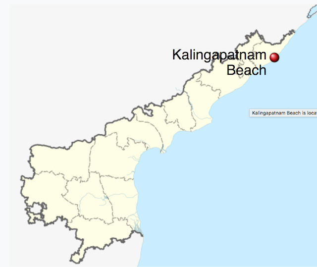
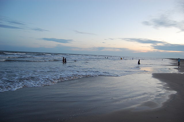
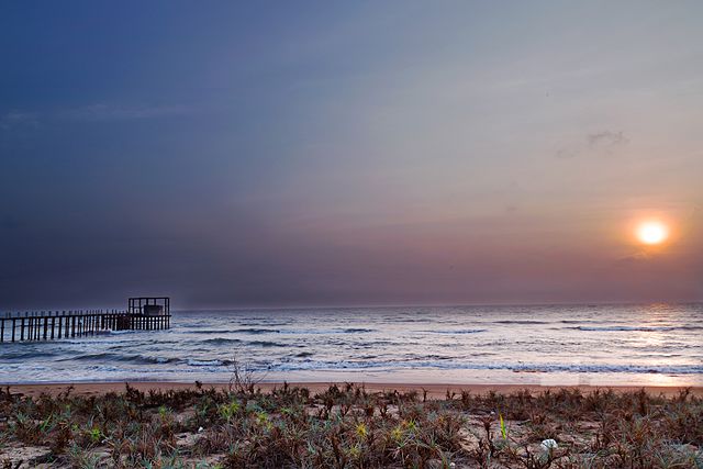
Kalingapatnam Beach is located on Kalingapatnam’s coast at the place where the Vamsadhara River drains into the Bay of Bengal. The former ancient harbor currently features a lighthouse and a Buddhist stupa. The beach reminds one of the thriving perfume and textile trade of ancient India prior to the British rule. The road to the beah ends on the sea shore bed and hence the Kalingapatnam Beach is popularly referred to as the Open Road Sea.

Manginapudi Beach 


Manginapudi Beach is located 11 km away from Machilipatnam and is maintained by the state’s tourism board.


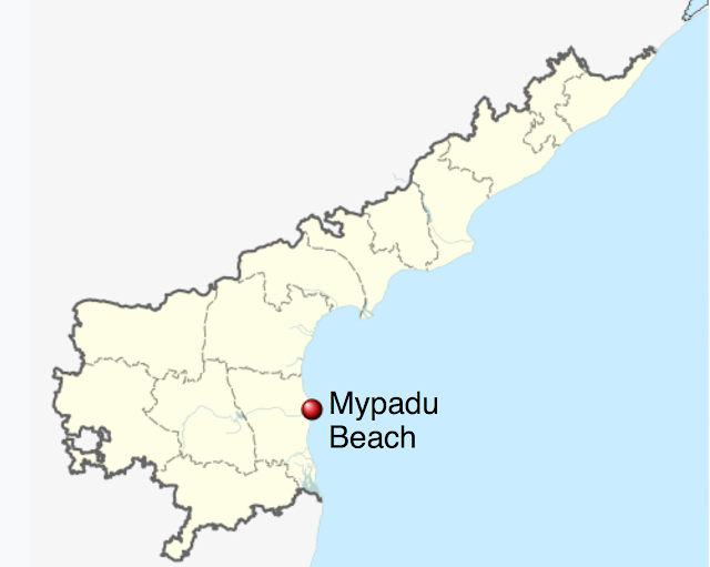
Mypadu Beach 


Located on the Bay of Bengal, the Mypadu Beach of Andhra Pradesh is only 25 km away from Nellore. The beach offers tourists with cruise options and fishermen can be seen fishing in the coastal waters along the beach. 


Development of water sports activities and establishment of beach resorts is taking place at a fast pace here.


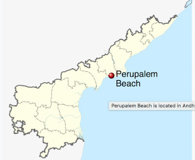
Perupalem Beach


Perupalem Beach is located in the West Godavari district of the state and is being currently developed for tourism.

Ramakrishna Mission Beach


The Rama Krishna Mission Beach is a well-touristed spot in Andhra Pradesh. The beach park derives its name from the Ramakrishna Mission ashrama located across the Beach Road from the park. The ashrama is a Hindu pilgrimage site equipped with guest-houses, and prayer halls. The Rama Krishna Mission Beach is also famous for housing the INS Kursura Submarine Museum where tourists. 


Visitors to the beach enjoy sunbathing, swimming, volleyball games, and other beach activities. Other attractions here include roadside restaurants serving mouthwatering delicacies, a Kali temple, an aquarium, and more.

Rushikonda Beach


The beach is located on the coast of the Bay of Bengal in the Andhra Pradesh state of India.

Suryalanka Beach


The Suryalanka Beach is located at a distance of 8 km from Bapatla in Guntur District of the Indian state of Andhra Pradesh.

Uppada Beach


Uppada Beach is only about 5 km from Kakinada in Andhra Pradesh’s East Godavari district. The beach here is wide and shallow. It is a popular fishing spot and prawn catches are famous here.

Vodarevu Beach


Vodarevu Beach is about 6 km from Chirala in the  Prakasam district of Andhra Pradesh. The shores of the beach are lined with coconut trees.

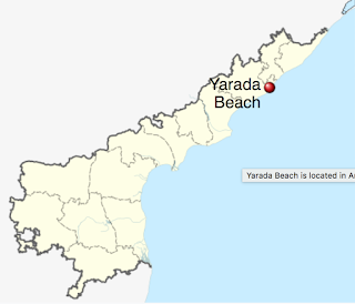
Yarada Beach


The Yarada Beach is located on the Bay of Bengal’s west coast in a village that is 15 km from Visakhapatnam. 


Some other beaches in Andhra Pradesh include the Antarvedi Beach, Koduru beach, Rama Puram Beach, Sagarnagar beach, Tenneti Park Beach, and others.

Saturday, February 18, 2017

The Unique Beaches Of Orissa: Why You Should Visit Them?

1. Puri Beach: Fun For All


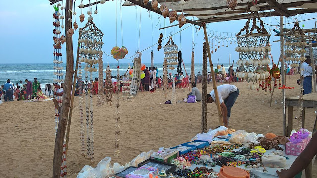
Perhaps the most famous and most visited of all beaches in Orissa is the Puri beach.  The Puri beach is known for its wide sandy beaches, rolling waves, and festive mood. The beach is located on the shores of the Bay of Bengal. The Puri beach is not only a beach destination but also a major Hindu pilgrimage site as it hosts a centuries old Hindu temple dedicated to a Hindu God.


Puri hosts hotels for all types of travelers from luxury to budget. The heritage crafts village of Raghurajpur near Puri is famous for selling vibrant and unique handicrafts and home decor items.


2. Gahirmatha Beach: Witness The Nesting Of Olive Ridley Sea Turtles


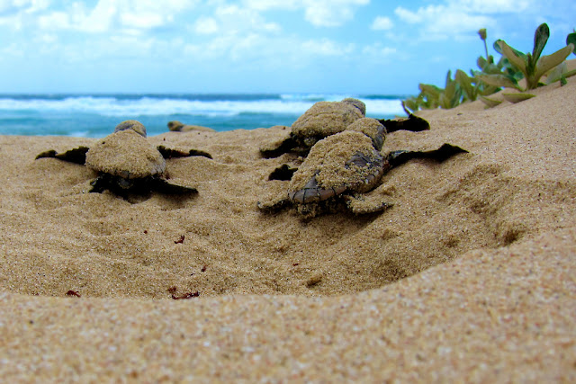
Gahirmatha Beach in Orissa is famous for being the nesting site of Olive Ridley sea turtles, and is witness to the aribada phenomenon where the turtles swim from the beach to the shore in a synchronous manner to nest at the Gahirmatha Beach during the nesting season. The beach is within the boundaries of the Gahirmatha Marine Wildlife Sanctuary. From the beginning of November every year, Olive Ridley sea turtles begin to migrate to masses to arrive at the Gahirmatha Beach for nesting. Due to prior cases of exploitation of the turtles visiting the beach, the nesting site of the turtles on the beach is currently kept under strict surveillance. 

3. Gopalpur: Come Enjoy Aquasports And Beach Festivals!


Gopalpur is a beach town in southern Orissa’s Ganjam district. Once a busy port, Gopalpur is now a popular tourist destination in the state. Located only 16 km away from Orissa’s commercial hub, Brahmapur, Gopalpur offers tourists a peaceful beach vacation. 


The gentle sand dunes, casuarinas, and coconut groves enhance the beauty of the Gopalpur beach. Several aqua sports like swimming, paddle-boating, scuba-diving, wind surfing, and paddle boat riding can be enjoyed by tourists visiting the beach. 


Every year, the town hosts the Gopalpur Beach Festival in the month of December and the town experiences a greater inflow of tourists during this time.

4. Chandipur: The Beach That Disappears


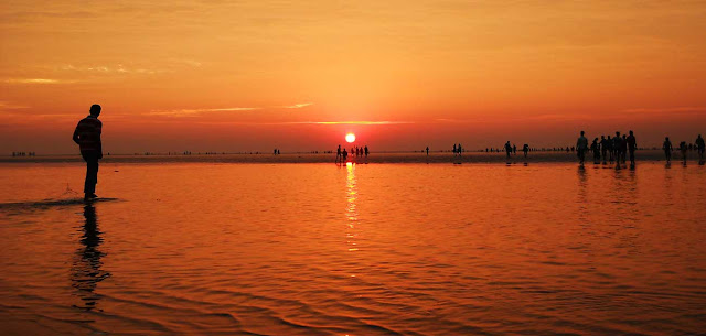
Chandipur, located about 16 km away from the Baleswar Railway Station, is a small sea resort famous for its disappearing beach. Here water of the sea recedes up to 5 km during the ebb tide. Due to this unique nature of the beach, tourists visit the place. Horseshoe crabs can also be sighted on the beach.

5. Talasari Beach: Face-to-Face With Pristine Nature 


Talsari, located in Orissa’s Baleswar district features picturesques beaches lined by rows and rows of palm trees from which it derives its name which means “palm (tal) and shari (rows).” Besides beaches, Talsari also features vast stretches of green paddy fields, blue mountains, and rivers. 


The beaches here are one of the least exploited ones in the state and hence are pristine and serene in nature. The waters here are also calm and peaceful. The estuary of the Subarnarekha River enhances the beauty of the beach. Tourists can also watch fishermen Talsari is located 36 km away from the nearest railway station of Jaleshwar and is 300 km away from the Bhubaneshwar airport. Several small hotels are also located here.

6. Konark Beach: Sun, Sand, Sea, And The Sun Temple 


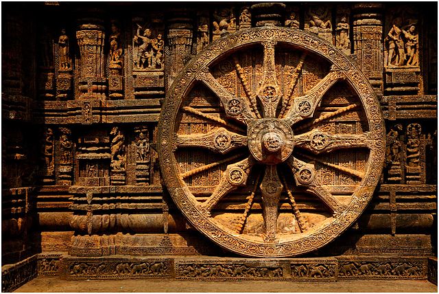
Combine the beauty of ancient Sun Temple of Konark and the white, rolling waves of the sea, and you  have the Konark Sea Beach. Less visited but one of the finest beaches in India, the Konark sea beach is only 3 km away from the UNESCO World Heritage site of the Konark Sun Temple. The temple is well-known across the world for its unique, aesthetic architecture and historical significance. The Konark beach also features the Ramchandi Temple, a Hindu temple.


Friday, February 17, 2017

Geography Of Punjab


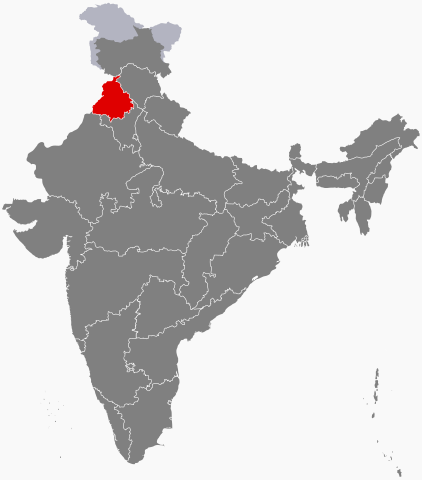
Where Is Punjab?

Punjab is a northern Indian state that is bordered in the north by the Indian state of Jammu and Kashmir and in the south and southeast by the Haryana state of the country. Himachal Pradesh borders Punjab to the east and Pakistan’s Punjab province lies to the west of the state. Punjab shares its capital, Chandigarh, a Union Territory, with the Haryana state of India. Punjab is often nicknamed as the “bread-basket of India” since it’s fertile soils yield good quality crops that serve as food for domestic consumption.


Climate Of Punjab

The state of Punjab experiences wide variations in temperature during the year due to its landlocked state and subtropical location. The state experiences three major seasons. Summer lasts from mid-April to June-end. During summer, temperature soars above 40 °C throughout the state. December to February are the coldest months in Punjab. During winter, only a few regions experience a temperature below the freezing point, ground frost is common throughout the state. The annual average temperature of the entire state is about 21 °C. Rainy season or monsoon prevails from July to September-end. During this time, the state receives rainfall from the monsoon winds flowing from the of the Bay of Bengal. Winter is also accompanied with some rainfall brought about by western disturbances. Rainfall in both these seasons is essential from crop growth in Punjab.

Topology Of Punjab

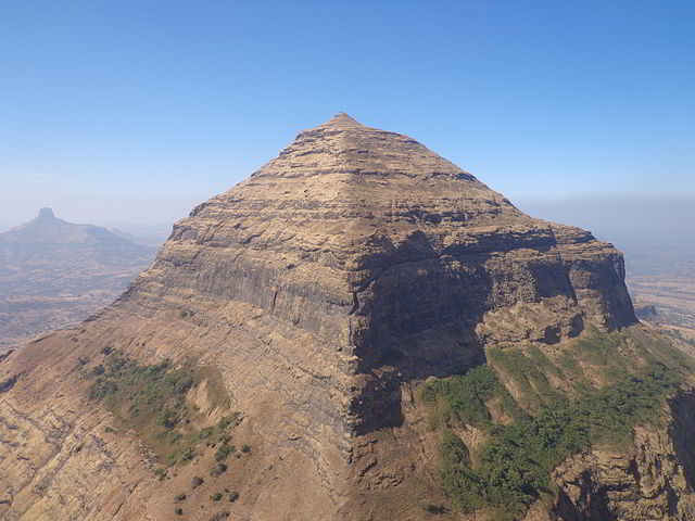
Punjab in northwestern India occupies an area of 50,362 square km. Large parts of the state lies in a fertile, alluvial plain criss-crossed by a large number of rivers. An extensive system of canals serve to supply water to the vast stretches of crop-fields in Punjab. The northeastern parts of the Indian state features a belt of undulating hills at the foot of the Himalayas. These hills have an average elevation of 980 feet above sea-level. A semiarid belt lies to the southwest of Punjab which gradually merges into the Thar Desert. 
Soils Of Punjab


The fertile plains of Punjab produces about two-third of India’s food grain supply. The state can boast of highly fertile soils of varied nature that allows the cultivation of a wide variety of crops. Soils in the south-western zone of Punjab is mainly calcareous in nature and has a pH value ranging between 7.8 to 8.5. Other types of soil like alluvial, regosol, and calsisol are also present in this zone. Soils in central Punjab varies from clayey to sandy loam and is alkaline in nature. In Eatern Punjab, soil is clayey to loamy. The parent rock, vegetation, climate, and topography are some of the factors that influence the soil type and quality in Punjab.

Hydrology Of Punjab


The name “Punjab” itself means “the land of five rivers.” Thus the five rivers of Jhelum, Chenab, Satluj, Ravi, and Beas bring life to the fertile plains of the north Indian state. The rivers originate from several small lakes in the Himalayan mountains and their tributaries criss-cross the state at various sections. The Beas river joins the Satluj River near Ferozepur after which the river enters the Punjab province of Pakistan to eventually drain into the Indus River. Sutlej is the longest among Punjab’s five rivers and rises in the Kalias Range in the Tibet region of China from where it meanders through the Himalayan region to enter Punjab and then merges with the Beas to enter Pakistan. The 960 km long Chenab River rises at the confluence of Chandra and Bhaga rivers in the upper Himalayas at Tandi. From here, it flows through Jammu of Jammu and Kashmir to enter Punjab. The Jhelum and Ravi soon join the river which then joins the Sutlej. 


The 720 km Ravi River originates in the Chamba district of Himachal Pradesh and crosses into Punjab near Madhopur by cutting a gorge in the Dhaola Dhar range. It then crosses the border into Pakistan to join the Chenab River. The Jhelum River is the biggest and most western of Punjab’s five rivers and is a tributary of the Indus River. The river rises from glaciers in north-eastern Jammu and Kashmir and enters Punjab in the Jhelum district. 

Symbols Of Punjab

State animal: Blackbuck (Antilope cervicapra)

State bird: Baj (Accipiter gentilis)

State tree: Sheesham (Dalbergia sissoo)


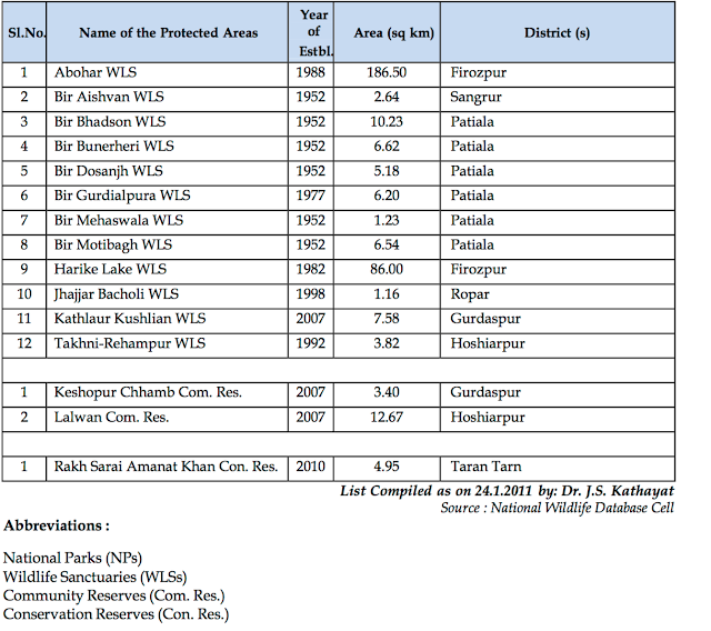
Protected Areas Of Punjab


Flora And Fauna Of Punjab


Punjab lacks much wilderness and thus wild vegetation is limited to patches of grass, shrubs, and bushes. However, several varieties of cultivated fruits, nuts, and vegetables like oranges, mangoes, almonds, figs, plums, mulberries, apricots, etc., are grown in the state. Most of the wild vegetation is confined to the Shivalik Ranges in the state which is known to be a mirco-endemic zone due to its rich flora and fauna. 355 species of herbs, 70 types of trees, 19 climbers, 21 types of twines, 31 pteridophyte species, 27 types of bryophytes grow in the micro-endemic zone. 

Punjab has a rich bird life with 396 species of avifauna residing in or visiting the state. 19 species of mammals, 20 species of reptiles, and 214 Lepidoptera species also live here. Large wetlands, bird sanctuaries, and zoological parks are present in the state. 

Some of the rivers of Punjab host crocodiles which can be dangerous to humans if approached by mistake. Camels can be seen in the semi-arid region to the south-west. Buffaloes can be observed grazing in the plans near the river. Wildlife sanctuaries in Punjab serve as the home of several mammalian species like wild boar, fruit bats, squirrels, wildcat, hog deer, etc.


Sunday, February 12, 2017

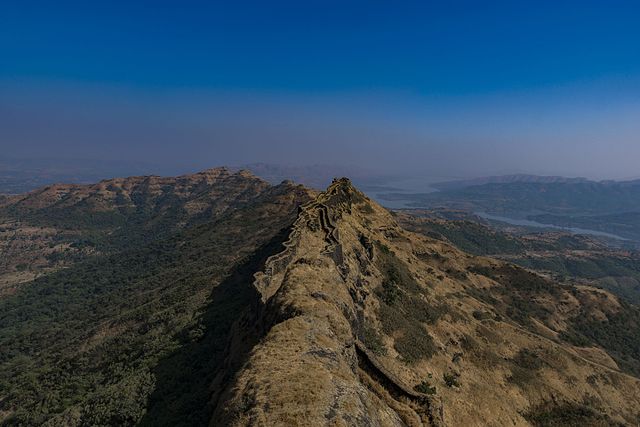
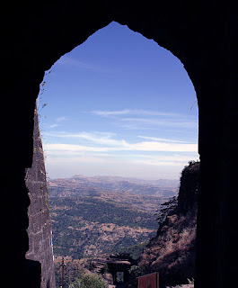
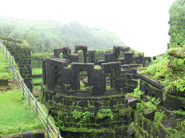
Magnificent Maharashtra: The Hill Forts And Highest Points Of Maharashtra, India


Kalsubai


Kalsubai is a mountain located in the Indian state of Maharashtra where it is part of the Western Ghat mountain range. The summit of the mountain is at an elevation of 5,400 feet. The mountain is thus called the 'Everest of Maharashtra’ and is the highest point in the state. Located within the limits of the Kalsubai Harishchandragad Wild-life Sanctuary, the Kalsubai mountain is highly popular among trekkers and wildlife enthusiasts. 

Salher 


Salher is a place in Maharashtra’s Nasik district that hosts the second highest peak in the Indian state (5,141 feet). Salher also houses the highest fort in the Sahyadri mountains. The fort is associated with years of history and was one of the most celebrated forts of the Maratha Empire. According to Hindu mythology, Lord Parshuram visited the fort for meditation. The fort also witnessed many battles during the reign of the patriotic ruler, Shivaji.


The town of Taharabad is nearest to Salher. Tourists often trek up the mountain to pay a visit to the historical fort. The climbing begins at the villages of Waghambe, Maldar, or Salher. The village Salher hosts a forest rest house while camps can also be laid down at the top of the Salher Fort. 

Dhodap 


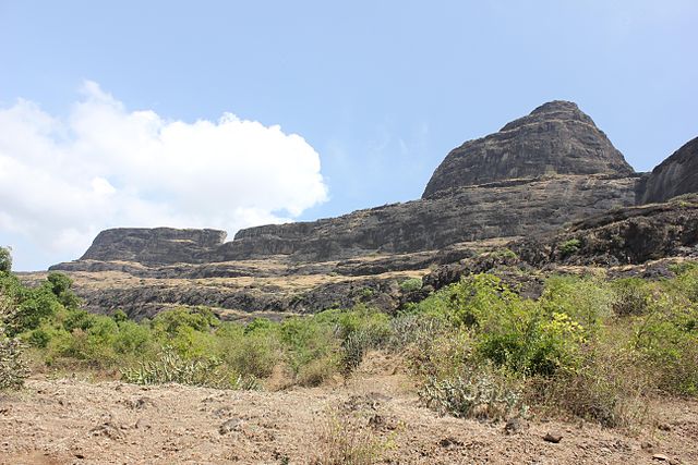
Dhodap is one of Maharashtra’s important hill forts. It is located at an elevation of 4,829 feet above sea level. Dhodap is also the state’s third highest peak after Kalsubai and Salher. Trekkers, history buffs, and adventurers love to visit the site by trekking. Local villagers help tourists to arrange for accommodation. Little clean water is available at the top so tourists are advised to carry sufficient volume of drinking water.

Taramati 

The Taramati is one of the two peaks of an Indian fort, Harishchandragad, dating back to the Yadav Kingdom. The place is popular among trekkers due to the scenic landscapes observed here.

Torna Fort


The 13th century Torna Fort, at an elevation of 4,603 feet, is one of the highest points in Maharashtra. The fort was the first one to be captured by Shivaji at the young age of 16 in 1643, and then acted as the central core of the great Maratha Empire. The fort was later annexed by the Mughals till it was once more handed over to the Marathas according to the Treaty of Purandar. 


The Torna Fort is about 50 km to the southwest of Pune and a popular trekking destination. The Menghai Devi temple provides accommodation facilities to the trekkers. 


Purandar Fort


The Purandar Fort is the an important fort of the Maratha Empire and is believed to be the birthplace of the son of Shivaji, Sambhaji Raje Bhosale.


Mangi-Tungi


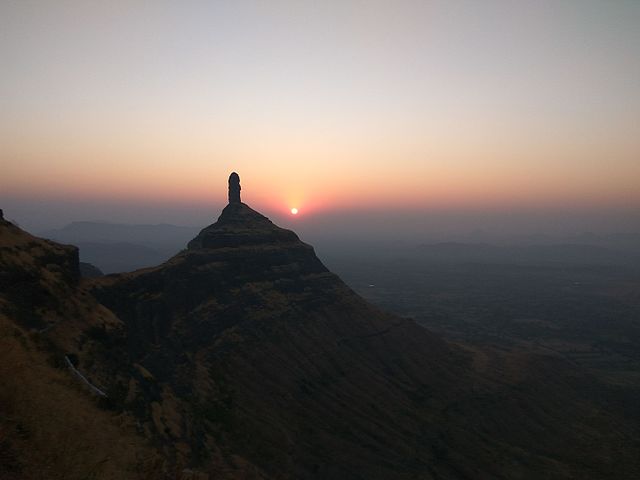
One of the most well-known high points in Maharashtra, the Manhi Tungi is a twin-pinnacled peak nestling a plateau in between them. The Mangi-Tungi is located about 125 km from Nasik near Tahrabad. 

Numerous temples sacred to Jainism are located in Mangi-Tungi. Around 3,500 steps lead to the peak’s foot. Once at the peak, tourists can enjoy sights of several monuments of great religious and historical significance. Numerous caves named after several Jain tirthankaras are also found here. One of the prominent features of the Mangi-Tungi is the 108 feet idol of Lord Rishabhanatha, the first Tirthankara in Jainism.


Rajgad 


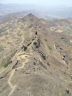
Rajgad is one of the highest points in Maharashtra. It hosts a fort at 4,600 feet above sea level that served as the capital of the Maratha Empire for nearly 26 years. The fort is at a distance of 60 km to the south-west of Pune. 


Adventurers and trekkers regularly attempt to climb the fort. The huge for is usually cannot be explored within one single day. Often, explorers prefer to stay overnight at the fort to enjoy all the explorable sites the fort has to offer. 

Sinhagad


Sinhagad (The Lion's Fort) is located about 30 km to the southwest of Pune city. One of the important battles fought here was the historic Battle of Sinhagad in 1671. The once extensive fortification is today in ruins and is a popular tourist destination for many. 


Ratangad 


Ratangad is a fort in Ratan Wadi, Maharashtra and one of the highest points in the state. Located at the boundary of the Thane and Ahmadnagar district, the Ratangad fort is often called the Jewels of the Fort. 

The 2000 year old fort comes alive with a plethora of beautiful flowers in November. Numerous sculptures, ancient wells, beautiful temples, etc., are located in the fort. The river Pravara/Amrutvahini also originates from Ratangad. 

Brahmagiri


The Brahmagiri is one of the highest peaks in Maharashtra. It is located in the state’s Nashik district. The Trimbakeshwar Shiva Temple and the origin of the Godavari River is near this peak. Several other spots of Hindu mythological and Indian historical significance are located in and around Brahmagiri.

Pratapgad


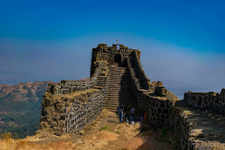
Pratapgad is a massive fort in Maharashtra’s Satara district. The fort, now a popular tourist destination, was the site of the historical Battle of Pratapgad. The fort is only 14 miles away from Mahabaleshwar, a popular hill station in the region. The fort can be reached by both a vehicle and by a scenic trekking route. 

Raigad


Rajgad is a hill fort located in Mahad, Maharashtra. An important fort of the Maratha Empire, today it is popular tourist destination in the region. 


          List Of Mountain Peaks Of Maharashtra