Saturday, October 29, 2016

Nature And Wildlife Destinations Near Lucknow, Uttar Pradesh, India


For those of you who are visiting the heritage city of Lucknow, famous for its Nawabs and their palaces as well as the Lucknow biryani, there are more treasures in store to be discovered near this age-old city. 

If you love wildlife and want to see some action in the wilderness, head over to the Dudhwa Tiger Reserve, one of the wildest and extremely scenic protected areas in India. For the avid birders, there are a number of places around Lucknow that can be visited for spotting the graceful beauties from around the world when they migrate to these bird sanctuaries in the winter. You can also watch the baby crocs of India being reared in the Kukrail Reserve Forest for release into the wild once they grow up.

Here is a list of wildlife destinations that can be reached within 5 hours or less from Lucknow city.

1. Dudhwa Tiger Reserve, 4h 18min


The Dudhwa Tiger Reserve is the best wildlife and nature destination near Lucknow. It is home to India’s national animal, the Royal Bengal Tiger, that enjoys a protected status in the Dudhwa Tiger Reserve. The Tiger Reserve, stretching across the Bahraich and the Lakhimpur Kheri districts of Uttar Pradesh comprises of the Dudhwa National Park, the Kishanpur Wildlife Sanctuary, and the Katarniaghat Wildlife Sanctuary. The total area occupied by the Dudhwa Tiger Reserve is 1,285.3 square km.


The Dudhwa Tiger Reserve is known for its surreal beauty. It is a vast alluvial floodplain criss-crossed by a number of rivers. Tigers, leopards, sloth bears, rhinoceros, barking deer, cheetal, swamp deer, wild boar, sambar, Asiatic black bears and other mammals call the Dudhwa Tiger Reserve their home. 400 species of birds and 90 species of fish are also found in the region. There are about 106 to 110 tigers in Dudhwa. 


2. Bakhira Wildlife Sanctuary, 4h 5min


The Bakhira Wildlife Sanctuary is a large wetland in Uttar Pradesh’s Sant Kabir Nagar District. The sanctuary is 44 km away from the city of Gorakhpur and occupies an area of 29 square km. It serves as the wintering ground of a large number of migratory birds. More than 100 villages are located along the banks of the lake in the sanctuary and depend on it for their sustenance. Winter is the best time to visit the Bakhira Wildlife Sanctuary. A resident bird of this sanctuary, the Indian purple moorhen is famous for its beauty. 


The Bakhira Wildlife Sanctuary can be accessed by:
Rail: Nearest railhead is Khalilabad.

Air: Gorakhpur Airport 49 km

Road: Gorakhpur-Khalilabad (35 km) NH-28, then Khalilabad-Bansi road 2 (17km).


3. Lakh Bahosi Bird Sanctuary, 3h 47min


A bird sanctuary encompassing two jheels (shallow lakes) and an area of 80 square km, the Lakh Bahosi Bird Sanctuary, is located near the villages of Bahosi and Lakh in Uttar Pradesh’s Kannauj District, at a distance of 40 km from Kannauj. Of the total 97 genera of birds residing in India, the Lakh Bahosi Sanctuary hosts 49 genera. Various migratory birds visit the sanctuary in winter. Some mammals that can be spotted at the Lakh Bahosi Bird Sanctuary include the fishing cat, blue bull, mongoose, and jackal. 

The Lakh Bahosi Bird Sanctuary can be accessed by:
35 km from Kannauj
90 km from Kanpur


4. Shahid Chandra Shekhar Azad Bird Sanctuary, 58min


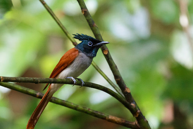
Also known as the Nawabganj Bird Sanctuary, it is located in Uttar Pradesh’s Unnao district on the Kanpur-Lucknow highway. It is a wetland habitat which provides a safe haven to 250 migratory bird species. A deer park, boating facilities on the lake, and a watchtower for spotting birds are also present at the Nawabganj Bird Sanctuary. Birds to this sanctuary arrive from Tibet, China, Siberia, and northern Europe. Some species of migratory and resident birds that can be spotted here are painted stork, white ibis, tern, whistling teal, peafowl, purple moorhen, Indian roller, shoveler, mallard, greylag goose, and others. 

Venomous snakes like cobras, kraits, and vipers also live in the Nawabganj Bird Sanctuary. Barking deer can be observed in the deer park of the sanctuary. A small guest house is present in the Nawabganj Bird Sanctuary along with a restaurant and children park.

November to March is the best time to visit this sanctuary. The Nawabganj Bird Sanctuary is located 45 km from both Lucknow and Kanpur and bus service from both cities to the sanctuary is available. Amuasi Airport is the nearest airport (35 km) and the Kanpur Railway station is the nearest rail-route to this sanctuary (45 km).


5. Parvati Aranga Wildlife Sanctuary, 2h 58min

The Parvati Aranga Wildlife Sanctuary was established in 1997 and encompasses two connected, rainfed lakes, the Parvati and the Aranga. Though no villages are located within the sanctuary, agricultural fields have encroached into the protected area as far as the banks of the lakes. A large number of waterbirds, about 20,000, populate the sanctuary in the winter months. The Parvati Aranga Wildlife Sanctuary is considered to be important for the conservation of Sarus. 


6. Kukrail Reserve Forest, 19 min


Only 9 km from Lucknow, the Kukrail Reserve Forest is a great wildlife destination for nature lovers visiting the city. The protected area is located in Indranagar in the vicinity of the Shivpuri Colony. The Kukrail Reserve Forest holds immense importance in the sphere of crocodile conservation, especially the conservation of India’s endemic crocodilian, the gharial. Crocodiles are bred in the reserve and crocodile eggs collected from the wild are allowed to hatch in protected environments. Young crocodiles are then allowed to grow till they are strong enough to defend themselves and then finally released into the rivers of the region.


Thursday, October 27, 2016

Geography Of Lakshadweep

Location Of Lakshadweep 


Lakshadweep or “one hundred thousand islands” is an archipelago in the Laccadive Sea in the Indian Ocean, 200 to 440 km off India’s south-western coast. Lakshadweep is a Union Territory in India and governed by the Indian Government. Kavaratti is the capital of this Union Territory.  coast. Lakshadweep is a Union Territory in India and governed by the Indian Government. Kavaratti is the capital of this Union Territory. 

The Lakshadweep archipelago is composed of 12 atolls, 3 reefs, five submerged banks, and a total of 39 islets and islands. 10 of its islands are inhabited, 17 are uninhabited. Kavaratti, Amini, Minicoy, and Agatti are the main islands of Lakshadweep.


Climate Of Lakshadweep

Lakshadweep experiences a tropical climate with little variance in temperature between summer and winter. The average temperatures ranges from 27° C to 32° C. April and May are the hottest months of the year. The southwest monsoon has the region under its influence from June to October and the average rainfall of 10-40 mm is received during this period. Rainfall decreases from the south to north. An average of 80-90 days in Lakshadweep are classified as rainy days each year. Humidity high for most of the year and ranges between 70% and 76%. In winter, the temperature ranges between 20oC to 32oC. The best time to visit the Lakshadweep islands is from October to March.


Soil Of Lakshadweep


The fragmentation of sedimentary rocks and coral limestones have contributed to the formation of soil in the Lakshadweep islands. The soil along the seashore is white in color and in the interiors is ash colored. The soil is calcium rich due to the limestone content of the soil.


State Symbols Of Lakshadweep


State Animal: Butterfly Fish


State Bird: Noddy Tern


State Tree: Bread Fruit


Type Of Vegetation Of Lakshadweep

Lakshadweep lacks endemic flora and forest cover is also absent in this Union Territory of India. Nearly 400 species of flowering plants grow in Lakshadweep including three species of sea grasses, fungi, lichens, algae, and angiosperms. Coastal shrubs and coconut groves grow in the coral sands.

Fauna Of Lakshadweep


Cattle and poultry birds are the common fauna observed in the inhabited islands of the archipelago. The domesticated cat is the only animal of the family Carnivora found in Lakshadweep. Mice are the only terrestrial mammalian species found in the wild. Though life on land is less varied that in the waters and coral reefs around Lakshadweep teems with a great diversity of aquatic and semi-aquatic fauna. 600 species of marine fishes, 52 crabs species, 78 coral species, 2 species of lobsters, 12 bivalve species, and 48 species of gastropods inhabit the coastal waters of Lakshadweep. 

A large number of birds (101 species) can be sighted in the region. Pitti Island in the archipelago has been declared a bird sanctuary. Some of the notable birds that can be spotted here include lesser crested tern, brown noddy, greater crested tern, reef heron

Terrestrial snakes are uncommon on the island but coral snakes might be sighted in the coral reefs of the island. A few species of sea turtles and amphibians can be spotted here.

Protected Areas Of Lakshadweep

Pitti (Bird Island) Wildlife Sanctuary

Monday, October 24, 2016

Geography Of Madhya Pradesh

Location Of Madhya Pradesh


As the name of Madhya Pradesh implies (“madhya” meaning central), this landlocked state of India is located in the heart of the country. Uttar Pradesh forms the northeastern border of the country, Maharashtra borders the state in the south, Gujarat in the southwest, and Rajasthan lies to the northwest of the state. Bhopal is the capital of this state. Madhya Pradesh occupies an area of 308,252 square km and a population of 72,597,565 as per the 2011 census.

Climate Of Madhya Pradesh

Madhya Pradesh experiences a subtropical climate with hot and dry summers and cool and dry winters. March to May are the summer months while winter is from November to February. The months of June to September are the monsoon months when the region receives the highest volume of rainfall. In summer, temperatures range between 25 °C and 40 °C. In winters, temperatures range from 10 °C to 25 °C. The average annual rainfall in Madhya Pradesh is 1,100 mm and precipitation decreases from east to west and is maximum in the southeastern parts of Madhya Pradesh. 

Topology Of Madhya Pradesh

The average elevation of Madhya Pradesh ranges between 300 and 3,900 feet. The land gradually rises from south to north in the northern parts of the state and from east to west in the southern part of the state. The Dhupgarh Peak in south-central Madhya Pradesh (4,429 feet) is the highest point in Madhya Pradesh.

Hills of Madhya Pradesh


Vindhya Range (west) and Kaimur Hills (northern branch of the Vindhya Range), elevation up to 1,500 feet.

Satpura, Maikala, and Mahadeo Range (south), elevation up to 3,000 feet.

Dhupgarh Peak (south-central), elevation of 4,429 feet and highest point in Madhya Pradesh.

Malwa Plateau (north-west of Vindhya Range), elevation between 1,650 feet and 2,000 feet.

Rewa Plateau (eastern part of Vindhya Range), 1,024 feet.

Bundelkhand Upland (north of Vindhya Range)

Madhya Bharat Plateau (extreme northwest of the state), average elevation of about 1,650 feet.

Baghelkhand Plateau (northeast)


Soil Of Madhya Pradesh

Four major types of soil are found in Madhya Pradesh: 

Black soil of the Malwa plateau region, parts of Satpura Range, and the Narmada Valley.

Red-to-yellow soil in the Baghelkhand region (primarily the eastern part of Madhya Pradesh)

Alluvial soil in northern Madhya Pradesh

Laterite soils in the highland areas of the state

Mixed soils in the Chambal division and Gwalior

Rivers Of Madhya Pradesh

Monsoons in Madhya Pradesh brings sufficient rainfall to feed a large number of rivers that originate and flow through the state. The largest among these rivers is the Narmada River, followed by the River Tapti. 


Narmada Basin
Godavari Basin
Mahi Basin
Tapti Basin
Mahanadi Basin
Ganges Basin
Chambal sub-sub basin
Kunwari sindh sub-sub basin
Jamni sub-sub basin
Betwa sub-sub basin
Dhasan sub-sub basin
Ken sub-sub basin
Paisuni and Baidhan sub sub basin
Tons sub basin
Sone sub basin
Shipra River
Kewai River
Johila River

State Symbols Of Madhya Pradesh


State Animal: Barasingha


State Bird: Indian paradise flycatcher
State Tree: Banyan
State Fish: Mahasheer

Types Of Vegetation

Among the state’s most notable trees are teak and sal (Shorea robusta), both of which are valuable hardwoods; bamboo; salai (Boswellia serrata), which yields a resin used for incense and medicine; and tendu, the leaves of which are used for rolling bidis (Indian cigarettes).

Fauna Of Madhya Pradesh


Madhya Pradesh hosts rich biodiversity. Large predators like tigers, panthers, and leopards are found in the forests of the state. Deer species like barasingha, sambar, chital, and blackbucks are also found in the state. Bears, gaur, elephants, wild boar are some of the other mammals found here. A large number of bird species can be sighted in Madhya Pradesh. The critically endangered gharial and the rare Gangetic dolphin is found in rivers of this state. 


Protected Areas In Madhya Pradesh

Abbreviations:
WLS: Wildlife Sanctuary
NP: National Park

Name of Protected Area


Bagdara WLS  
Bandhavgarh NP
Bori WLS
Fossil NP
Gandhi Sagar WLS
Ghatigaon WLS
Kanha NP
Karera WLS
Ken Gharial WLS
Kheoni WLS
Madhav NP   
Narsinghgarh WLS
National Chambal WLS
Noradehi WLS
Orcha WLS
Pachmarhi WLS
Palpur-Kuno WLS
Panna (Gangau) WLS
Panna NP
Panpatha WLS
Pench (Priyadarshini) NP 
Pench WLS
Phen WLS
Ralamandal WLS
Ratapani WLS
Sailana WLS
Sanjay Dubri WLS
Sanjay NP
Sardarpur WLS
Satpura NP
Singhori WLS
Son Gharial WLS
Van Vihar NP
Veerangna Durgawati WLS


Saturday, October 22, 2016

Geography Of Tripura


Location Of Tripura


Tripura is North East India’s landlocked state and part of the Seven Sister’s group which along with this state includes the 6 other states of Assam, Meghalaya, Arunachal Pradesh, Nagaland, and Arunachal Pradesh, and Manipur. Tripura encompasses an area of 10,491.69 square km and is the third smallest state in India. It extends from 91°09'E to 92°20'E and 22°56’N to 24°32’N. The country of Bangladesh forms the western, southern, and northern borders of Tripura. Assam borders it in the north-east and Mizoram in the east. The national highways that pass through Mizoram’s Mamit District and Assam’s Karimganj District connect Tripura to these states.

Climate Of Tripura

A tropical savanna type of climate prevails in Tripura and the state experiences four major seasons: Summer or pre-monsoon (March to April); monsoon (May to September); post-monsoon (October to November); and winter (December to February). The uneven terrain of Tripura also leads to regional variances in the climate of the state.

Heavy rains and frequent floods are common during the monsoon season. 1,979.6 to 2,745.9 mm was the average rainfall received between 1995 and 2006. Summer temperatures  range between 24 °C  and 36 °C while winter temperatures range between 13 °C to 27 °C. The state is also highly susceptible to strong winds and cyclones.

Topology Of Tripura

Hill ranges, valleys, and plains form the topography of this north-eastern state of India. Tripura has 5 anticlinal ranges and 5 synclines in between these ranges. The hill ranges run from north to south from Boromura in the west of Tripura to Jampui Hills in the east. The 5 valleys or intervening synclines between these anticlines are the Dharmanagar–Kanchanpur, Kailasahar–Manu, Kamalpur–Ambasa, Khowai–Teliamura, and Agartala–Udaipur. The state is highly susceptible to earthquakes and lies on Seismic Zone V.


The highest peak in Tripura hidden beneath the tree cover.

The highest point in Tripura is the 3,081 feet tall Betling Shib in the Jampui Range. The state also has isolated hillocks called tillas and valleys called lungas

Soil Of Tripura

The narrow valleys and flood plains of Tripura have fertile alluvial soil while the hills have porous, red laterite soil. Agricultural land is found mostly in the south and west of the state. 

Rivers Of Tripura


Tripura has 10 major rivers which are primarily rain-fed, hence transient in nature. The rivers carry a high volume of water in the rainy season and dry up in the summer. Unfortunately, deforestation in the catchment areas of Tripura’s rivers has led to a further loss of water from these rivers in the summer season. 

Tripura has 10 major rivers and several smaller streams, lakes, and ponds. At least 13 lakes are present in the Trishna wildlife Sanctuary and at least 3 in the Sepahijala Wildlife Sanctuary which attracts migratory birds to the region.

State Symbols Of Tripura


State Animal: Phayre’s Langur


State Bird: Green Imperial Pigeon

State Tree: Agar


State Flower: Nagesar

Ecoregions Of Tripura

The Indian state of Tripura, like the rest of the country, lies in the Indomalaya ecozone. Forest cover in the state was 57.73% of the total land cover in 2011. Mountain, freshwater, and forest ecosystems exist in the state. 

Types Of Vegetation

Evergreen forests (hill slopes and sandy banks of rivers): Eugenia, Dipterocarpus, Amoora, Syzgium, Artocarpus, etc.

Bamboo and cane forests are interspersed between evergreen and deciduous vegetation. 

Moist deciduous forests of 2 types: 
  1. Moist-deciduous mixed forest
  2. Sal-predominant forest

Grasslands and swamps (plain region): Swamps (Macaranga, Albizia, Lagerstroemia, Barringtonia); Grasslands (Phragmites, sugarcane, shitalpati)

Fauna Of Tripura


90 mammalian species belonging to10 orders and 65 genera call Tripura their home. Elephants, wild dog, porcupine, sambar, wild boar, binturong, barking deer, leopard, clouded leopard, gaur, several species of primates and small cats live in the state. Nearly 300 species of birds and several species of reptiles, amphibians, fishes, and invertebrates are also found in Tripura. 

Protected Areas In Tripura

1 Clouded Leopard National Park
2 Rajbari National Park
3 Gumti Wildlife Sanctuary
4 Rowa Wildlife Sanctuary
5 Sepahijala Wildlife Sanctuary
6 Trishna Wildlife Sanctuary