Location Of Madhya Pradesh

As the name of Madhya Pradesh implies (“madhya” meaning central), this landlocked state of India is located in the heart of the country. Uttar Pradesh forms the northeastern border of the country, Maharashtra borders the state in the south, Gujarat in the southwest, and Rajasthan lies to the northwest of the state. Bhopal is the capital of this state. Madhya Pradesh occupies an area of 308,252 square km and a population of 72,597,565 as per the 2011 census.
Climate Of Madhya Pradesh
Madhya Pradesh experiences a subtropical climate with hot and dry summers and cool and dry winters. March to May are the summer months while winter is from November to February. The months of June to September are the monsoon months when the region receives the highest volume of rainfall. In summer, temperatures range between 25 °C and 40 °C. In winters, temperatures range from 10 °C to 25 °C. The average annual rainfall in Madhya Pradesh is 1,100 mm and precipitation decreases from east to west and is maximum in the southeastern parts of Madhya Pradesh.
Topology Of Madhya Pradesh
The average elevation of Madhya Pradesh ranges between 300 and 3,900 feet. The land gradually rises from south to north in the northern parts of the state and from east to west in the southern part of the state. The Dhupgarh Peak in south-central Madhya Pradesh (4,429 feet) is the highest point in Madhya Pradesh.
Hills of Madhya Pradesh

Vindhya Range (west) and Kaimur Hills (northern branch of the Vindhya Range), elevation up to 1,500 feet.
Satpura, Maikala, and Mahadeo Range (south), elevation up to 3,000 feet.
Dhupgarh Peak (south-central), elevation of 4,429 feet and highest point in Madhya Pradesh.
Malwa Plateau (north-west of Vindhya Range), elevation between 1,650 feet and 2,000 feet.
Rewa Plateau (eastern part of Vindhya Range), 1,024 feet.
Bundelkhand Upland (north of Vindhya Range)
Madhya Bharat Plateau (extreme northwest of the state), average elevation of about 1,650 feet.
Baghelkhand Plateau (northeast)
Soil Of Madhya Pradesh
Four major types of soil are found in Madhya Pradesh:
Black soil of the Malwa plateau region, parts of Satpura Range, and the Narmada Valley.
Red-to-yellow soil in the Baghelkhand region (primarily the eastern part of Madhya Pradesh)
Alluvial soil in northern Madhya Pradesh
Laterite soils in the highland areas of the state
Mixed soils in the Chambal division and Gwalior
Rivers Of Madhya Pradesh
Monsoons in Madhya Pradesh brings sufficient rainfall to feed a large number of rivers that originate and flow through the state. The largest among these rivers is the Narmada River, followed by the River Tapti.

Narmada Basin
Godavari Basin
Mahi Basin
Tapti Basin
Mahanadi Basin
Ganges Basin
Chambal sub-sub basin
Kunwari sindh sub-sub basin
Jamni sub-sub basin
Betwa sub-sub basin
Dhasan sub-sub basin
Ken sub-sub basin
Paisuni and Baidhan sub sub basin
Tons sub basin
Sone sub basin
Shipra River
Kewai River
Johila River
State Symbols Of Madhya Pradesh

State Animal: Barasingha
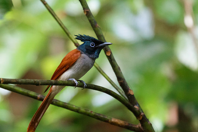
State Bird: Indian paradise flycatcher
State Tree: Banyan
State Fish: Mahasheer
Types Of Vegetation
Among the state’s most notable trees are teak and sal (Shorea robusta), both of which are valuable hardwoods; bamboo; salai (Boswellia serrata), which yields a resin used for incense and medicine; and tendu, the leaves of which are used for rolling bidis (Indian cigarettes).
Fauna Of Madhya Pradesh

Madhya Pradesh hosts rich biodiversity. Large predators like tigers, panthers, and leopards are found in the forests of the state. Deer species like barasingha, sambar, chital, and blackbucks are also found in the state. Bears, gaur, elephants, wild boar are some of the other mammals found here. A large number of bird species can be sighted in Madhya Pradesh. The critically endangered gharial and the rare Gangetic dolphin is found in rivers of this state.

Protected Areas In Madhya Pradesh
Abbreviations:
WLS: Wildlife Sanctuary
NP: National Park
Name of Protected Area

Bagdara WLS
Bandhavgarh NP
Bori WLS
Fossil NP
Gandhi Sagar WLS
Ghatigaon WLS
Kanha NP
Karera WLS
Ken Gharial WLS
Kheoni WLS
Madhav NP
Narsinghgarh WLS
National Chambal WLS
Noradehi WLS
Orcha WLS
Pachmarhi WLS
Palpur-Kuno WLS
Panna (Gangau) WLS
Panna NP
Panpatha WLS
Pench (Priyadarshini) NP
Pench WLS
Phen WLS
Ralamandal WLS
Ratapani WLS
Sailana WLS
Sanjay Dubri WLS
Sanjay NP
Sardarpur WLS
Satpura NP
Singhori WLS
Son Gharial WLS
Van Vihar NP
Veerangna Durgawati WLS
No comments:
Post a Comment